Technical Information
|
General Details
Type of competition: Rogaining - Rugged Outdoor Group Activity Involving Navigation and Endurance. Mode: Team race on foot (from 2 up to 5 members) Duration: 12 (long), 6 (medium) and 3 (short) hours. Distance: Undefined, depending on how fast you go. It is estimated that the winning team of 12 hours, finish doing over 60 kms. Timing: SPORTident System FEDO Judge controller: Antonio López Lara Race Director: Manuel López Medina Technical Director: Gastón Mora Madrid Safety Director: Ignacio Palla Fernández Map
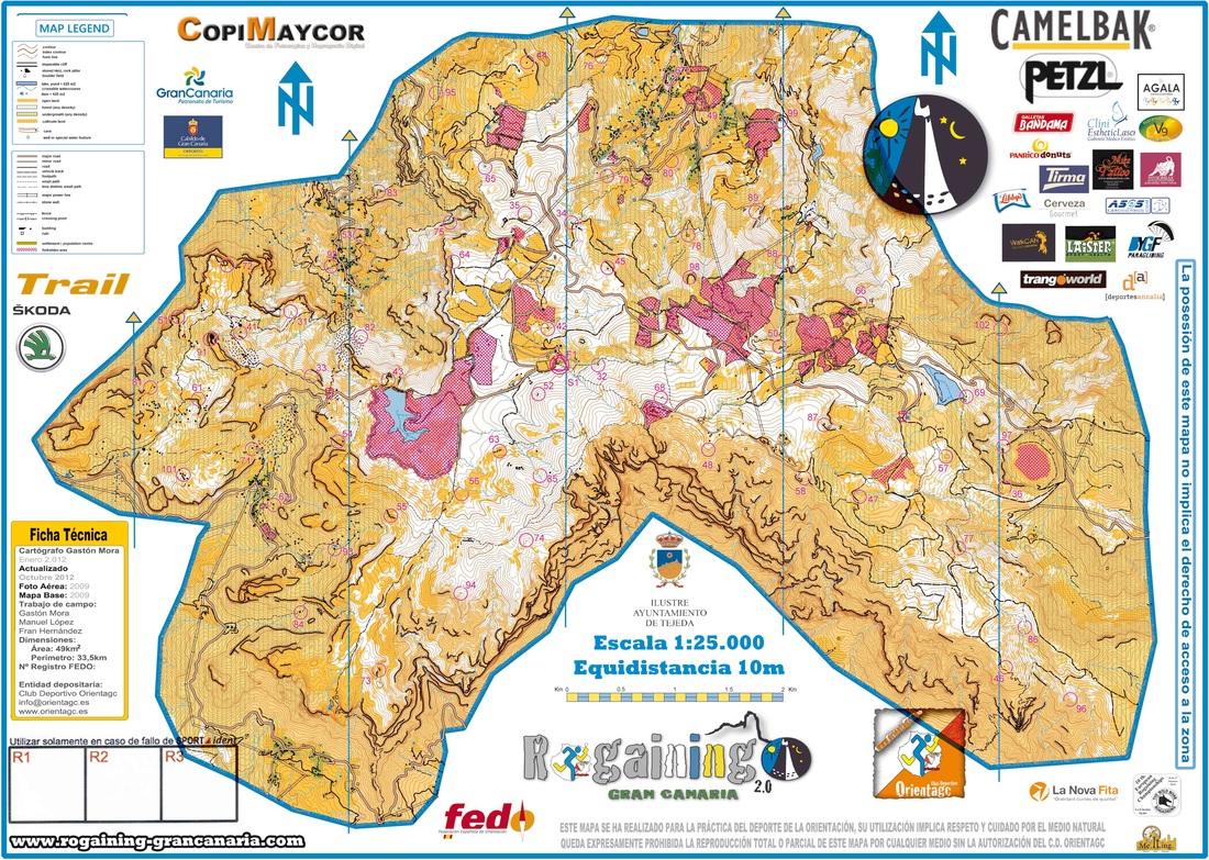
Cartographer: Gastón Mora Madrid Date of realisation: December 2012 Updated: Autumn - Winter 2017/2018 Area: 48,8 km2 Perimeter: 33,5 km Scale 1: 25,000 Equidistant 10 meters Minimum height: Maximum height: 1945 meters Paper format: a sheet of SRA-3 Base mapping: GRAFCAN Symbols: Specific to orienteering adapted for the competition. NOTA: el mapa de PROMO 3 horas tendrá las siguientes especificaciones: Area 12 km2 Perímeter 19 km Tracing
Tracer: Fran Hernández / Manolo López Number of controls: 66. 10 more will be placed specificly for the PROMO 3 hours race. Total points: 402 Optimum length: coming soon Optimum accumulated elevation: coming soon Maximum accumulated score: coming soon Maximum control score: 9 point. Minimum control score: 3 points. Minimum penalty: According to FEDO regulation (5 points) Maximum penalty: According to FEDO regulation (50 points -> 30 minutes). From there the team will be disqualified. Terrain description
The race will take place in the geographic centre of the island forming the boundary limits of the municipalities of San Bartolomé de Tirajana, Vega de San Mateo, Valsequillo and Tejeda. There are various protected landscapes within the race terrain including the mountainous area called “Las Cumbres”, the natural monument “Cliffs of Tirajana” and the “Nublo” Rural Park. When you crown the central plateau of the summits of Gran Canaria, you will see the north, east and west fall away smoothly in contrast to the southern part which is cut abruptly by cliffs hundreds of feet deep. These cliffs form Tirajana’s crater. The terrain on which which the plateau stands, with an age of 3 million years, consists of volcanic agglomerates(rock bombs formed from the eruption of the volcano) of the Volcanic Series II or Roque Nublo of Gran Canaria. The result of the collapse of an ancient stratovolcano. It is covered with Canarian Pine Trees, repopulated in the 1950s. Amidst the pine forest or rocky areas, are yellow broom and species adapted to high altitude and severe weather conditions like mountain Chamomile, mountain Thyme or white sage. The peak itself is an inaccessible rocky outcrop. A few meters from this peak is a viewpoint of the same name, El Pico de Las Nieves, which is accessible by road. Almost all the land surrounding the Pico de las Nieves at its summit is partly owned by the Armed Forces of Spain. Here they have placed radar and telecommunication systems. Tracing
The type of race scoring is characterised of: ● Open selection of the control points. It is not compulsory to go to all of them. ● Open order of the control points. It is not compulsory to go to them in any specific order. ● At each control point there is a specific score according to the difficulty of finding them. Every time a team passes a control point, they accumulate their score for the final result. ● Arriving to the end outside of the stipulated time(3, 6 or 12 hours) will be penalized with points deducted from the final overall score. The penalty is proportional to the delay. ● The team with the highest points scored will be the winners. In effect, paths do not exist as such. However, the positioning of the markers will determine the choice of the route, establishing imaginary paths/tracings. The tracer should place and score the control points to have clearly the route he/she wants, suggesting alternatives and raising questions from the participants in order to make them think about the control points and how to attack them. To all this, we have to add the time limits to get to each control. This makes it impossible to get to all the optimal scoring control points within the time limits, therefore forcing you to plan a different route to get to the controls you wish to score. Add to the above the fatiguing of the participants, which could also make them alter the route so as not to arrive too late. We have tried so that most of the control points can be attacked from at least two sides. However, in a lot of cases good orienteers will know how to read the map and adventure on unmarked routes. Something that is not exempt of risk. As we have mentioned in the description of the terrain, it is important to read the contour lines, the condition of the paths and the kind of vegetation you will encounter to be able to attack the control point as efficiently as possible. Another important detail to take into consideration is the score given to each control point. We have tried to do it with the following criteria: ● Distance to cover. ● Physical difficulty of the route (basically, the gradient) ● Technical difficulty of the route (type of terrain, orientation) ● Aesthetics (we have placed the control points in interesting settings) As has been said, we have “tried” to follow these criteria, but there will be situations in which it may appear that this has not happened. Why? Because depending on how you attack a control point, it may be easier or more complicated, therefore possibly causing some confusion and making you think that a control point with a higher score may be easier to get to and viceversa. In these situations we have tried to sense the obvious attack route to assign the score, but, as we have said, in various cases it is very difficult to know what is the most obvious route, and that’s why we have assigned a compromised/commitment score. |
Symbology
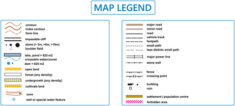
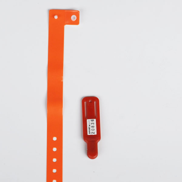
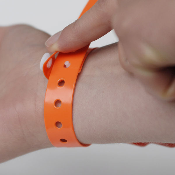
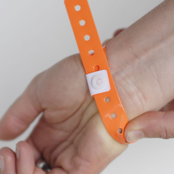
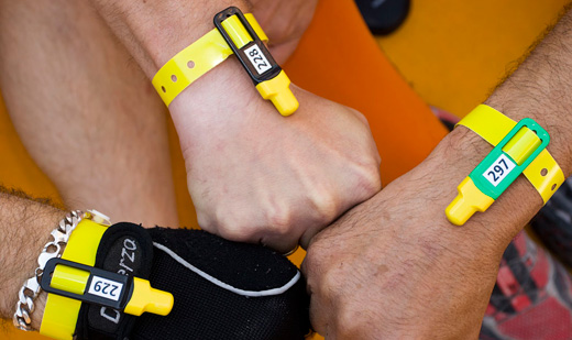
Trails and Tracks The trails and tracks are represented on the map with different black lines. The thickness of the line will give you the width of the path while the dashed line will give you the degree of difficulty to find it. The thickest lines have being used for paths that are more than 1,5 metres wide. The thinnest lines have being used for those tracks and trails with a width less than 1,5 metres. The lines with shorter dashes will let you know that the path can be lost any given moment, so you will have to be alert here. Roads Take great care when crossing any roads. Vegetation To facilitate reading of the map (do not forget that the scale is 1: 25,000), we have simplified representation of vegetation by not including the penetrability of it and lowering the shades of color to see more clearly the contours on the map...very important when planning the route. We have placed special emphasis on the boundaries of vegetation visible from aerial photos, usually been good references for navigation from one point to another. Leyenda SI CARD, Instructions for fitting Competitors are responsible for the correct fitting of the SI-Card clamp with bracelet provided by the organization. Bracelet passes through the slot in the SI-Card
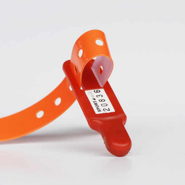
Adjust the bracelet enough so it does not come off during the race. Close bracelet as shown below and cut off the rest to avoid possible tearing. Make note that your bracelet is on tight enough. It shouldn’t come off even if you try to do so. If your band is not sufficiently tight enough you can request another one.
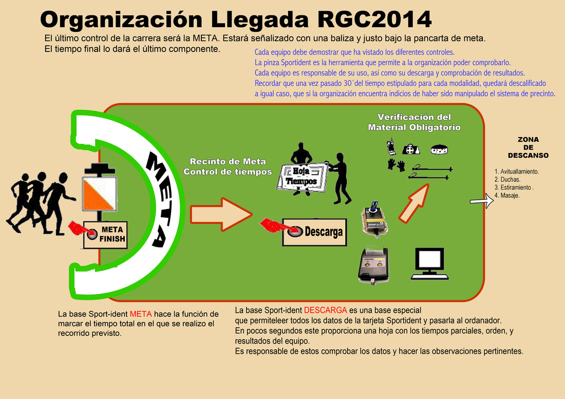
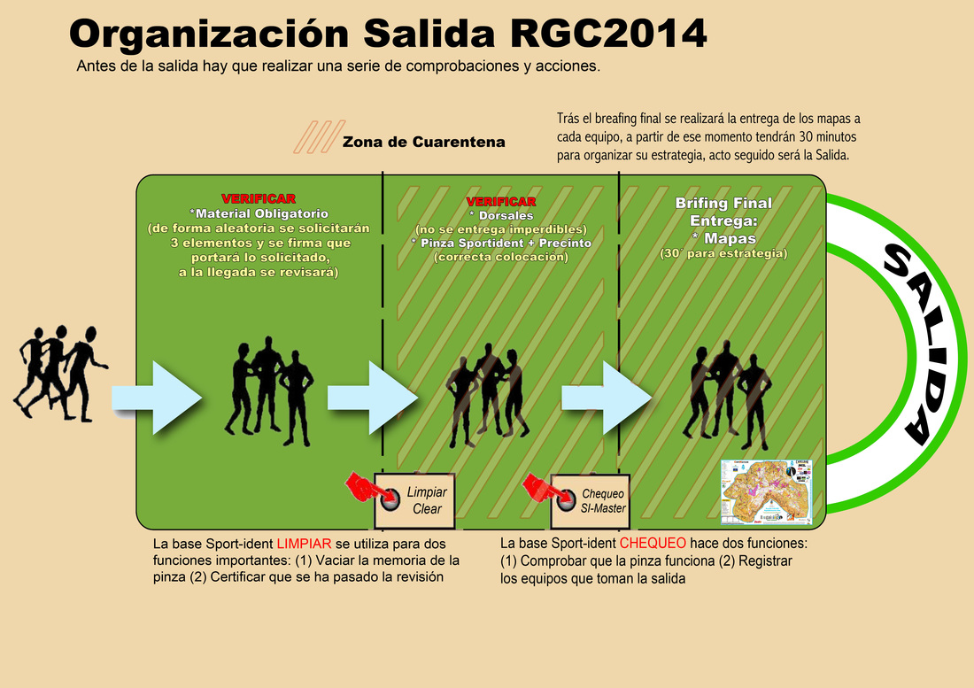
PLEASE REMEMBER THAT ANY ATTEMPT TO REMOVE THE BRACELET AT THE TIME OF REVISION OF MATERIAL WILL MEAN AUTOMATIC DISQUALIFICATION FOR YOUR TEAM. Sistema de Salida Sistema de Llegada/META
|

